Capability
PCT Agcloud provides specialist tools to get the job done quickly and effectively.
SETUP, IMPORT DATA AND API CONNECTIONS
-
- Import and manage all major OEM data formats.
- Including all operations – Ground Preparation, Planting, Application and Harvest.
- Import Soil Surveys from EM, DualEM, Veris and others.
- Import Soil Sample data (grid and zone) from multiple sources.
- Get soil or tissue results directly from the lab.
- Build data structures to match and connect with John Deere, Agworld and CNH.
- Pull and push data to PCT Gateway, John Deere, Agworld and CNH.
- Import data from many 3rd parties like SMS, STS and Farmworks.
- Import Polaris soil data and Gamma Radiometrics and more.
DATA EDITING
-
- Automatic geospatial assignment of data to fields.
- Automated data correction and cleaning for selected crops.
- Manage overlaps and clean headlands.
- Correct for latency and distance offset.
- Balance multi machines and data distributions.
- Use advanced sensor drift management corrections.
- Process your data to interpolated grids.
- Create derivatives from your datasets like Profit Maps and more.
VIEW
- Visualise data and make informed decisions.
- Multiple synchronised views.
- Build soil sampling plans, zone and grid.
- Compare layer and create pdf graphs.
- Create reports of data layers and operations.
- Paint zones on data layers.
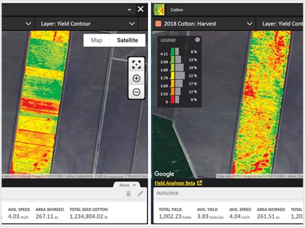
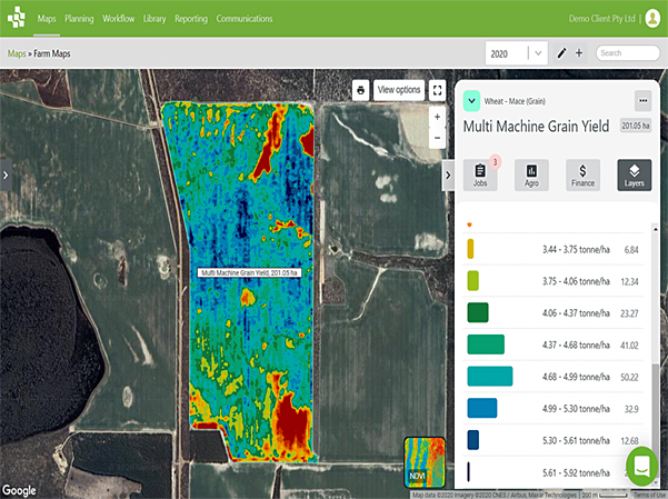
- View yield data layers with common colours across all fields.
- Quickly access other PCT Agcloud
- Apps with a simple right click and more.
DATA ANALYTICS
- Build correlation scatterplots from multiple years of yield and imagery.
- Determine and create management zones with data layers that correlate.
- Build multi temporal yield average layers and yield potential layers for other crops.
- Compare soil sample results to yield and other data layers.
- Create soil estimate layers from sample and surveys. E.g. Field Capacity and AWC.
- Create a range of sensible layers that agronomists and growers can use.
- Create and analyse strip trials with accuracy and valid statistics.
- Use powerful field analytics to make the complex quick and easy to interpret.
ZONE/LOCATIONS
PCT Agcloud:
- Create zones from single or multiple layers.
- Create Smart Start Zones from EM and LSC – the best place to start.
- Build Intelli Risk Zones using three layers such as EM, LSC and Yield.
- Compare zones vs yield and analyse change in real time as zones are adjusted.
- Save zones to build Prescriptions in the Rx building app and more.
PRESCRIPTIONS
- Create nutrient prescriptions quickly from data layer, points and formulas.
- Control prescription outputs to match available product and manage cost.
- Create single product prescriptions for multiple fields with manual entry.
- Create multiple product prescriptions for single fields and insert strip trials accurately and quickly.
- Create PDF reports to easily share planned application for checking and ordering products.
- Create multiple field and multiple product shapefiles.
- Send shapefiles to Agworld or John Deere Operation Center as well as send direct to equipment.
- Send shapefiles to Agworld and CNH, as well as send direct to equipment in John Deere Operations Center.


- Retrieve Field Boundaries to easily synchronise Grower, Farm and Field structure.
- Automatically retrieve machine data daily and auto clean, correct and process application and planting.
- Auto clean, correct and process yield data.
- Sentinel Imagery every 3-7 days when cloud free.
- Soil Survey layer such as EM, Veris, Gamma, Management Zones, and USDA Soil layers.
- Soil sampling layers – grid sampling layers.
- All data as a contribution map layer.
- Upload raw yield, application and planting from any brand – yes it processes as a field operation.
- Create virtual harvest data. Cleaned an interpolated grid yield to Operations
Center and it processes as a yield operation layer.

- Retrieve field boundaries to easily synchronise grower, farm and field structure.
- Automatically synchronises cleaned and processed layers to the connected Agworld account.
- This inlcudes soil survey (EM, Veris, gamma), elevation, management zones, planting and yield layers.
- Allows seamless operation using a common and coordinated data set across both platforms

Want to know more about PCT Agcloud?
Contact us using the form below and one of our team members will get back to you.